May 2021- Death Valley National Park
We pack up and headed out for the desert early. Death Valley is about 2 hours from Las Vegas, and it was a LONG 2 hours. As I mentioned in my Hoover Dam blog, there really is mile and mile and miles of Nothing as you drive away from Las Vegas. We searched the skyline and indeed it was empty. Any signs of life was trucks surrounded by solar energy grids that often will span for many miles as well. Every once in a while a dirt road would span in a far off direction making us wonder if it was an actual road or a atv path. We certainly would not risk the drive with the rental. Also along several of these paths would be a random RV or trailer parked below the beating sun. We made it to Pahrump NV, which seemed to be the only glimpse of civilization between Las Vegas and the Valley floor. Gassed up, stocked on H20 and soon we were back to it. As we drove past a hand written sign reading LAST GAS BEFORE DEATH VALLEY, I commented, that can not be true. Only 7 more miles to Death Valley and it was still another several to the first visitor center. Then we saw the sign. We are HErE!!!
We stopped and did the must do National Park sign photo before we made our way to the 1st stop on our way. Zabriskie Point.
One of the most beautiful landscapes throughout Death Valley are these views. We did the climb up to the top to get a full look at all of the beauty. The point is so named after Christian Brevoot Zabriskie the vice president of the Pacific Coast Borax Company.
It makes you wonder if we were to drain the ocean floor, would something below look like this?
Once we got our fill of the beautiful rock formations, we headed back to the car and made our way to the visitors center where I got a ton of information about where we must go while we were here as well as getting my National Park pass stamped. Another one checked in the pursuit to visit all of the National Parks. This makes #6 of the 62 National Parks. I've got a ton of sightseeing left to do apparently. But 1 more down at least. So we were told an absolute must see is the Badwater Basin.
Appropriately named Bad water as it not refreshing. I believe the story goes, after a mule traveling with a surveyor refused to drink from the spring, it was simply stated that's some BAD WATER. The water is full of salt.
I did actually touch this crusted salt formations along the walk way out into the flats, as they are called and touched this finger to my mouth. YEP, it's salty alright.
There is very little water pooled along the basin while we visited, it did not look inviting anyway.
The thing about why we were informed that we must stop at this sight is that it is the lowest point in the North America at 282 feet below sea level.
Mark and I walked along the salt flats, which look like it might be miles of sand stretched out into the desert, but it actually looks more like concrete with some loose water areas.
After our visit at Bad Water we headed towards Artist Drive.
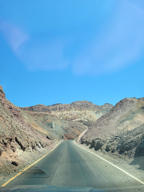
This one way drive takes you through winding tight roads into the beautiful mountain formations.
Minerals and formations of rocks make up a display of beautiful colors.
The road was so winding and small. It was really kind of cool to drive through these mountains.
It was so incredibly beautiful. Many of the areas here were used in the movie Star Wars. The national Parks service has a self tour on their website describing all of the locations.
Death Valley was not always a National Park of course, and before it was seen as such, it was (1994) pretty much a place to avoid, the area hits insanely high temps. In July of 2012 Death Valley reached an all time record high of 134 degrees. This is the highest verifiable temp, in the world. Hot days and cold nights. The coldest temp on record at Death Valley is 15 degrees. Add to the fact that there is very little shade and even less water, death valley is not an encouraged inhabitable place by any ones account. On average about 3 people die per year just from the heat alone. Other dangers include rattlesnake, scorpions and black widow spiders. Despite these insane living conditions there was once an entire "town" of people who lived and worked here mining the minerals found in vast supply in the area.
Borax or sodium tetraborate is often used as laundry detergent and cleaning products.
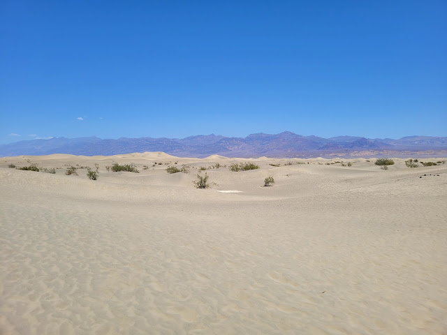
Mark and I did a walk around the reminders of Harmony Borax minds before making our way to the Mesquite Flats Sand Dunes. We had been told NOT to stray to far from our cars by the ranger while visiting this area. People get lost in the desert, and this area was the only part of Death Valley that we saw that really looks like what most people think of when they think desert. Sand and sand and sand.
We walked off from the parking lot, but not to far. It is pretty.
Although there are a few additional areas in Death Valley that are identified as places to visit such as Devils Golf Course and Natural Bridge, The Race Track (Where rocks move by themselves), Dantes View and father Crawley Point. We had decided that we had a full day and it was best to start heading out of the park. The park itself is the largest park in the National Park systems and there are many miles between each viewing area. As stated earlier just getting to the park was long. We made our way towards the exit heading towards where we had our hotel reservations. On our way out, we actually began to really see that we were in a Valley, climbing up and out made me concerned that the car may overheat. It is truly a steep climb back out, one we had not noticed coming into the park, but we had exited at a different location.
We drove out of the park and soon came upon the town of Rhyolite, NV. There is an outdoor art park along with an abandoned mining town.
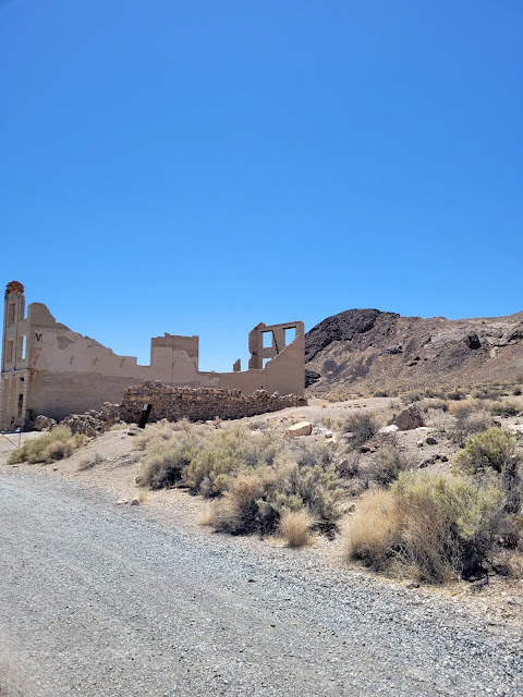
Just up the road from the art museum is the Rhyolite Ghost Town. Once a large town during the gold rush of the early 1900's. Once named Bullfrog and founded by prospectors Frank "shorty" Harris and Eddie Cross in 1904. By that winter Bullfrog Hill's had about 1000 people living in tents scatted around the mines. It was around for about 10 years before the gold mine dried up. This became part of the bullfrog mining district. (we somehow missed the bottle house, which is perhaps the best still standing building. Below was the stone, it had every thing to purchase.
Due to growth and demand for the ore, in 1907 the Bullfrog Goldfield railroad was established.
The Cook Bank is below. It also housed the post office and business's on the second floor. This along with a few other buildings once had electric and running water.
School's, bars, stores, gambling establishments once populated these grounds. This was a large town, but once it was at a loss for production. Miners and families left Rhyolite just as quickly as the town had boomed.
The term Bullfrog mine was potentially named because of the ore sample was green stained and shaped like a frog. There is no solid proof of this however.
 |
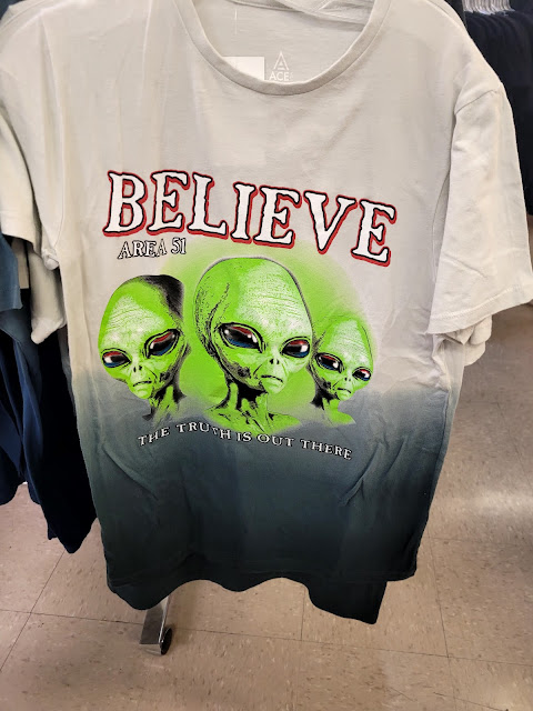
Just a few more miles down the road, we stopped at the Area 51 Alien Center. SAY WHAT?? I had no idea we were so close to AREA 51. I love the mystery of the the area where aliens are suppose to be tested on and the like.
This Kookie store and eatery offered souvenirs of the famous military base that was to be stormed in 2019. If you are so interested in the stories of odd things happening at Area 51 simply google Area 51/aliens and you will get a read-full of interesting things. Although I may be interested, my hubby is not at all. We did the tourist walk through of the store and I purchased a magnet, but we did not take the additional 40 plus miles to the gates of Area 51 from this little store.
We instead headed to our hotel for the night, The LongStreet Inn and Casino. This was an odd little place on the border of Nevada and California. Although odd it had a lovely grounds, with a pond, pool, small casino, eatery and a small pin of animals.
We had a late lunch/early dinner before we spent the rest of the evening in our room that overlooked the pond.
The views of the setting sun was amazing.
This was the end of our Las Vegas trip. The following morning we headed back to Las Vegas to catch our plane back to NY. What a great trip! TTFN


No comments:
Post a Comment